RICK CRANDALL

This site is a collection of articles on subjects that may be of interest to researchers.. They are all copyrighted, however abstracting and quoting may be done without my permission (although I’d like to know!) and literal copying may be allowed, contact me. 

Yale Mountain 14,196’ In the “Collegiates”

p_pdf

Difficulty: Class 2
Exposure: None
Summit: 14,196 feet
Elevation Gain: 4,300 feet
Roundtrip: 8.00 miles
Trailhead: Denny Creek at 9,900’

Climbers:  Brett Crandall and Amos; Rick Crandall and Emme  September 11, 2007

Yale Mountain In the “Collegiates”

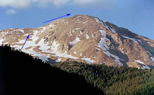
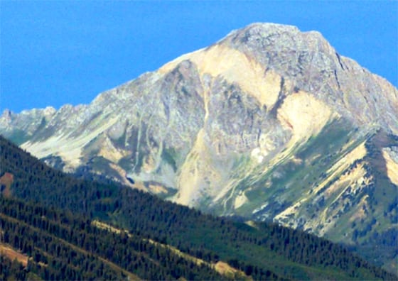
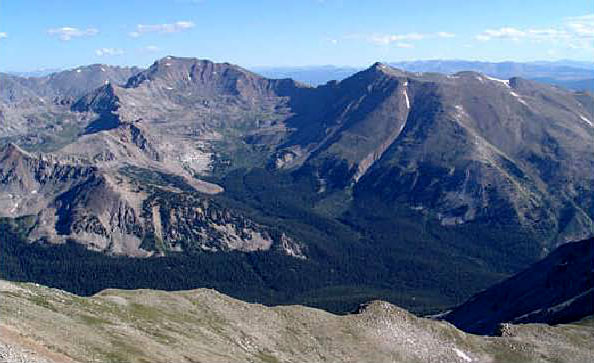
Upper portion of the route to Yale Mountain peak seen from County Road 306

Rick and son Brett left Aspen at 4am with Emme the Australian Terrier mountain-hiker dog and Amos, Brett’s dog. We drove over Independence Pass to the center of Buena Vista, and got onto County 306 road towards Cottonwood Pass. We drove 12 miles on this “road” to reach the Denny Creek Trailhead still completely in the dark.

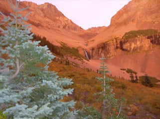
We had enough ambient light to start the hike with no headlamps. Soon we saw the sunrise which was warming.

From 11,300′ to 11,900′, we hiked northeast and then east through the forest. We left the trees at 12,000′ and continued east as the trail approached a large shoulder. Once on the shoulder, the trail turned northeast toward Yale’s upper west slopes. The remainder of the route was then visible.


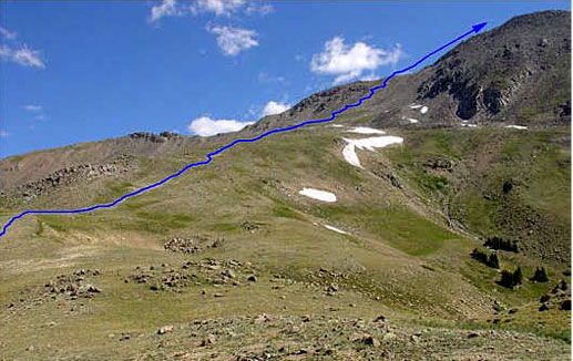
Near 12,100’ about halfway up, viewing the remaining hike to the summit ridge.

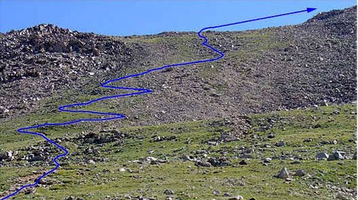
At 13,000’ just about to start up the switchbacks of the steep approach slope.

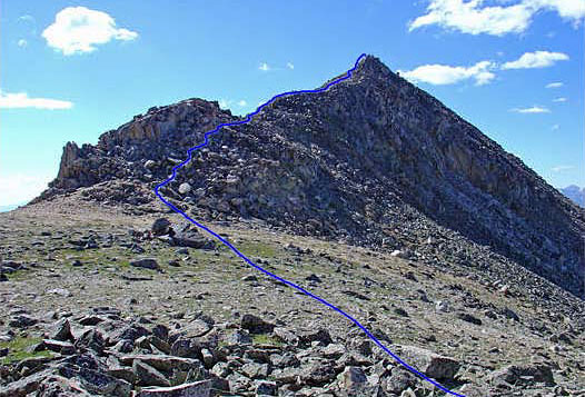
The summit ridge seen from 13,900’ on the saddle. The summit is not yet visible.
The last 1.5 miles to the summit is steep and slow going.

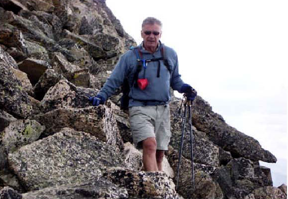
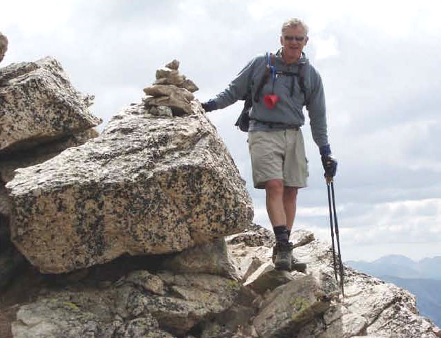
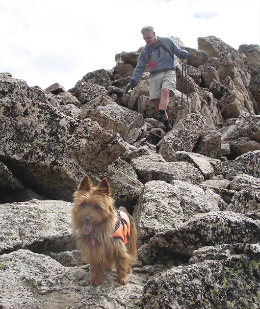
Rick about to start the rock climbing on the summit ridge.

Near 13,200′, we began the steep climb up the slope to the summit. Cranked steeply up 700′ of elevation gain to reach the saddle at the top of the slope (13,900′) where the trail quickly disappeared. We scrambled along the ridge crest by working along either side of the ridge.

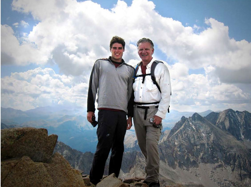
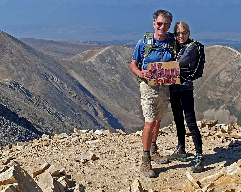
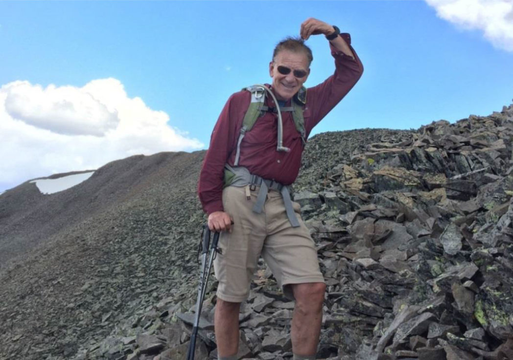
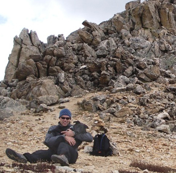
Brett and Rick at the summit.

On the summit, looking north to Mt. Harvard and Mt. Columbia (right) also 14ers.

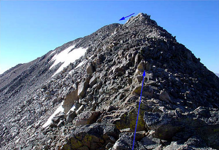
Rick heading down, just feet from the summit above on the right

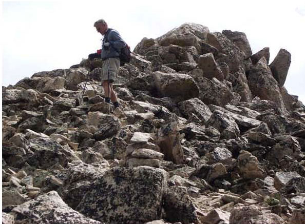
Passing a “cairn” – a pile of rocks used to show the way when no route is visible.

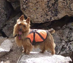
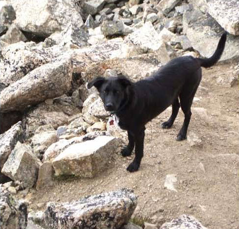
Emme is quite happy to lead the way – up and down. Aussies love climbing – Emme showed time and again if she couldn’t find a way over a boulder, she’d find a way around it.

Amos is a hiker too!

Brett and Amos (below) – just down from the summit ridge.

Back below tree-line and nearly done – of course Brett got there first – by a mile!


p_pdf

Welcome

This site is a collection of articles on subjects that may be of interest to researchers.

They are all copyrighted, however abstracting and quoting may be done without my permission (although I’d like to know!) and literal copying may be allowed, contact me.

See Hiking and Climbing Equipment Checklist HERE

New Articles

Climbing a New York City Skyscraper

In Hudson Yards, NYC there is a building called the Edge that has the highest cantilevered deck in North America at the 100th floor. We elevatored to there and then went outside to climb to the top!

Mt. Sherman Revisited

After four years passing from finishing climbing all 58 fourteeners, I am back at a summit on Mt. Sherman with Mona Long.

My Favorite 14er Climb Stories

San Luis Peak – via Creede and the South Ridge

A shocking (literally hair-raising) story. We found this approach was the best. Even summiting at 10am we got hit by multiple electrical storm cells that arose with no warning and discharged into us right at summit! We ran and got sufficiently down before the discharges took the form of full lightning bolts.

Automatic Crystal Parlor Fountains

Based on a pneumatic principle by physicist Heron of Alexandria in AD 62, the Automatic Crystal Fountain combines beauty with captivating geyser-like fountain using no apparent motive power.

El Diente – Climbing a hard Fourteener

El Diente – A Hard Mountain in the San Juan Range El Diente is not often climbed and indeed it has its challenges. We liked the south ridge approach from the Kilpacker trailhead. From that direction the view of El Diente is impressive and the Kilpacker Basin is a feast for the eyes.

Mt. Daly – the “one with the stripe”

Mt. Daly is on the other side of the saddle from Capitol Peak. It is one of the most visible mountains to those traveling between Aspen and Snowmass. While not a 14er, it is a named 13er with a fun Class 3 ridge-crest climb that is less frequently done. There is also not much written about the best way up, solved here in this story.